PASTRENGO PIAZZA CARLO ALBERTO. 13
Alberto Tomei
Elena Spolaore
Andrea Turato
PROJECT
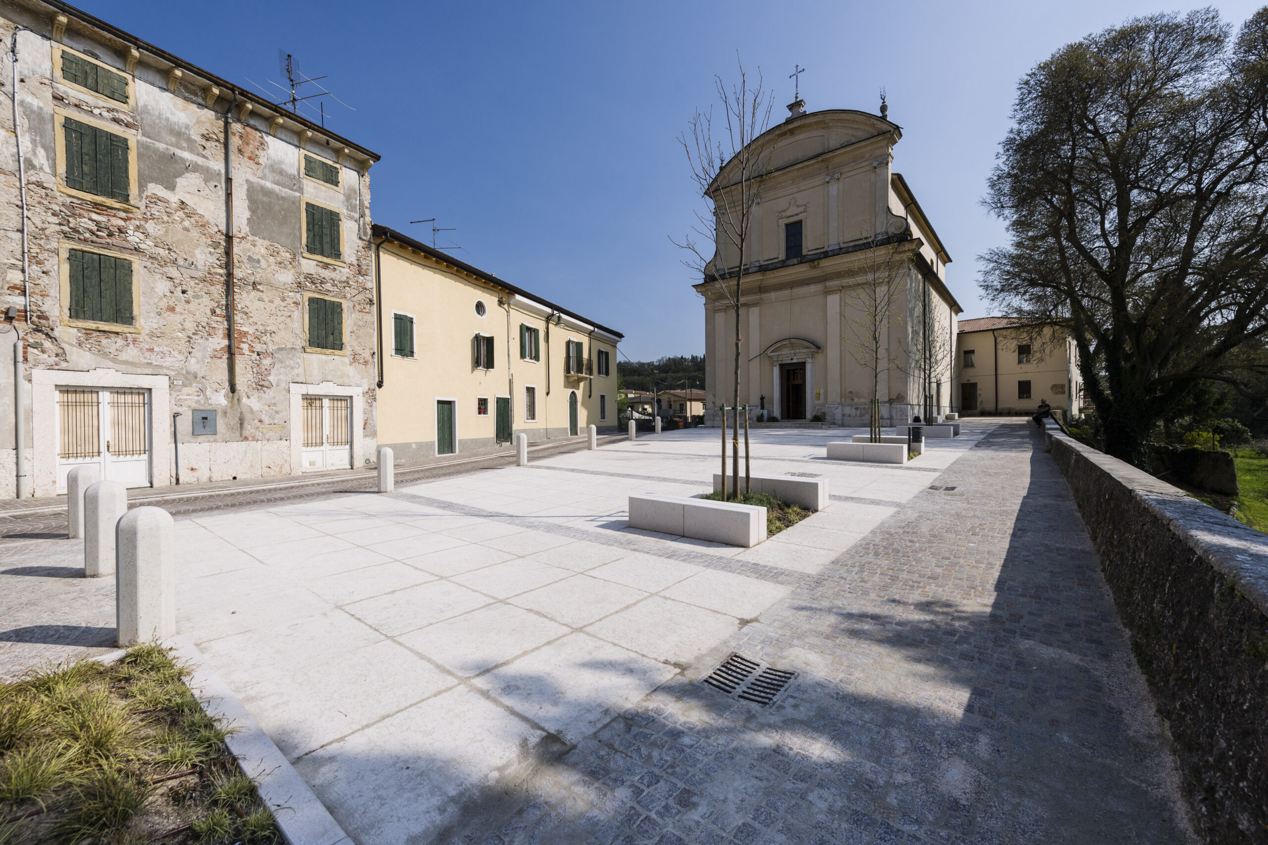
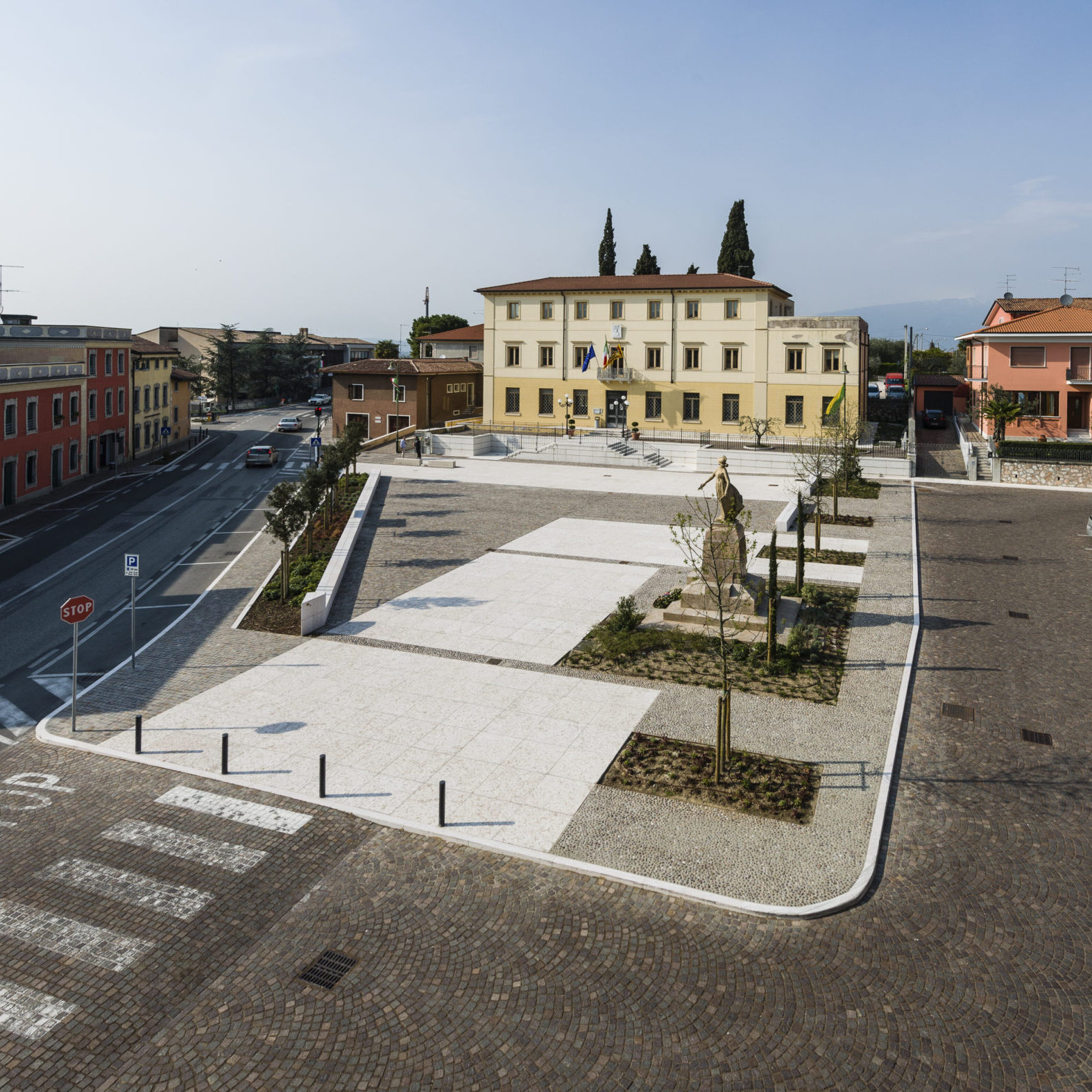
In the historic center of Pastrengo, in the 19th century, the axis of via Roma and the church square was consolidated, while to the west, in the mid-19th century, a “Building for use by the Town Hall and Municipal Schools” was built. Along the road axis, which reaches from north to south next to the Town Hall, the “Monumento ai caduti per la Patria” is placed, which definitively made it a public space. In the following years, due to the presence of the provincial road, the space of Piazza Carlo Alberto accelerated in its urban development, between the 1950s and the 1970s with new urban fronts of poor quality, while the rest of the historic center depopulated and emptied of commercial activities. Piazza Carlo Alberto had particularly attractive functions such as the municipal building and some nearby commercial establishments, but the car park and the bus stop occupied all the available space in the square. Paved in asphalt, it was not very usable for the community and of poor quality, despite the fact that very important national events took place there, such as the Festa dei Carabinieri for the re-enactment of the Battle of Pastrengo of the First War of Independence. Beyond the provincial road that runs along the square to the west, behind the twentieth-century building backdrop, a little-used car park was built a few years ago which, together with the car park behind the municipal building, could lighten the square from the constant encumbrance of cars. At the center of the square was the Monument to the Fallen which served more as a roundabout than as a structuring element of the urban space. The creation of a large pedestrian space facing the municipal building has created an interesting urban perspective, accentuated by the design of the pavement (made with geometries parallel to the facade of the Town Hall) which is made up of local materials. In this space, careful use has been made of porphyry cubes, in continuity with the existing pavements of via Roma, of large slabs of Lessinia stone, as in the Veronese tradition, interspersed with linear elements of cobblestone coming from the Adige, which runs along the city. Given the civic use of the square, the Venetian red pole has been inserted with the weather vane and the sphere, typical of the Venetian squares, which plays an important role in the relationship between the town hall and the monument, moving the center of gravity of the square from the provincial to the civic heart of the pedestrian space. The design process was structured according to “design moves” which can be summarized as follows:
- limitation of vehicular traffic and movement of the bus stop along the provincial road;
- enhancement of pedestrian connections with existing car parks and with pedestrian paths in the urban landscape (Hapsburg fort and historic centre) and the hill of San Zeno towards the Adige with its rural villas;
- reduction of parking lots and rest areas;
- creation of hedges and low-trunk trees to protect from the state road and tall trees to mask some low-value buildings;
- extension of the pedestrian area;
- integration with existing floors;
- reuse and relocation of some stone elements present in the square (historic nineteenth-century benches);
- integration of the war memorial into the design of the square;
- integration with the existing town hall stairway;
- insertion of the Venetian pole with the wind vane.


